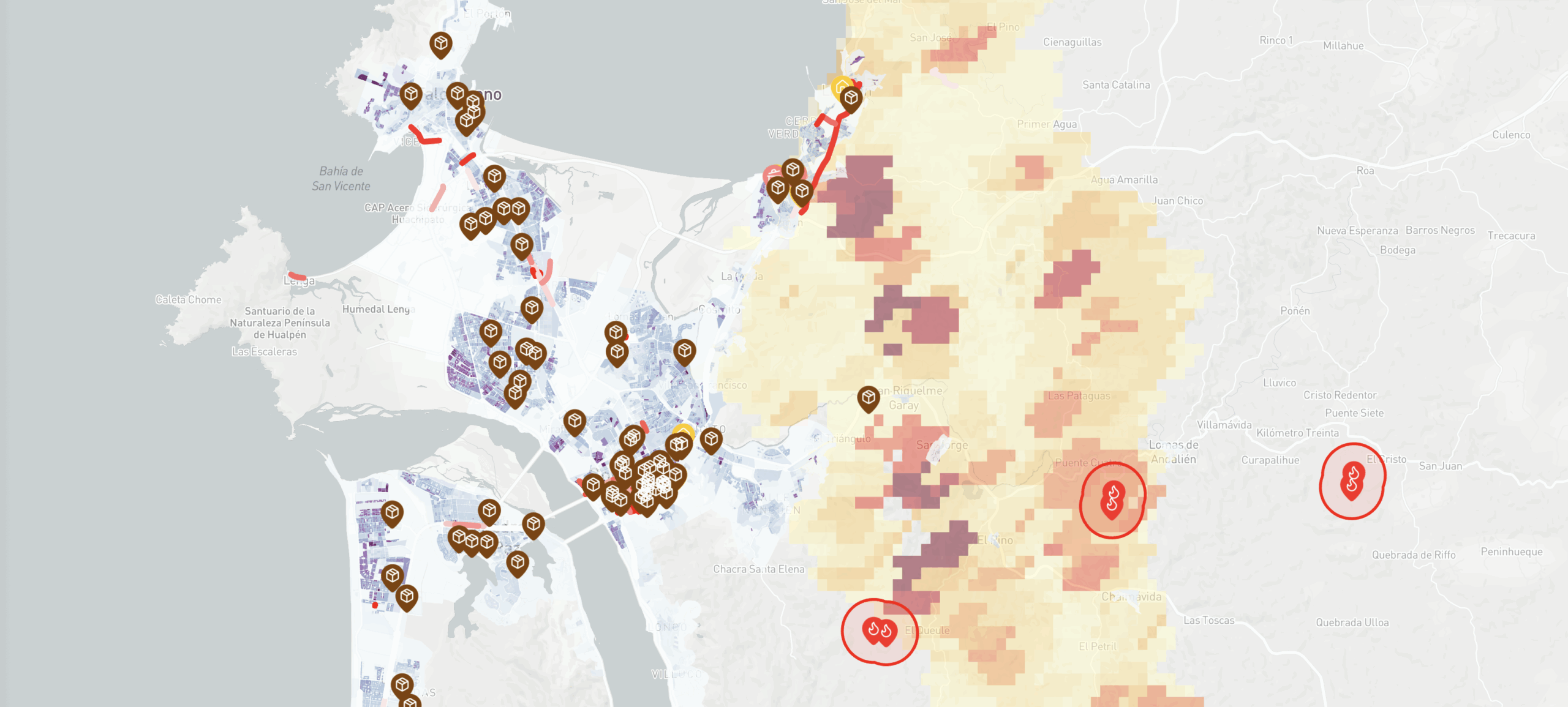
Amid the emergency caused by wildfires affecting the Biobío and Ñuble regions, City Lab Biobío is supporting the Biobío Regional Government with integrated territorial information to aid technical emergency management. The lab provides a daily set of analytical resources that help track the spatial evolution of the fires using satellite imagery.
At the same time, the lab launched a public viewer developed in collaboration with Deep-Hub and Imagine-IT. It includes demographic information for populations living in potentially affected areas, the location of homes, the presence of critical infrastructure such as schools and hospitals, and connectivity data, including street closures and disrupted roads. The system integrates official and open data from NASA FIRMS, INE, the 2024 Census, IDE Chile, and Waze. All of this complements official figures, providing a comprehensive territorial view of the emergency and supporting decision-making.
“The information on this platform has been incorporated both to support decision-makers in managing the emergency and to provide the general public with an open tool that promotes transparency and a clearer understanding of the situation in the affected regions. It is a living platform, and we hope more organizations will contribute data that can enrich this tool,” says Fernando Pérez, the lab’s principal director for City Lab Biobío.

Fernando Pérez
Director Principal City Lab Biobío
With this initiative, City Lab Biobío reaffirms its role as a technical support for public management in crisis situations, putting urban data science at the service of disaster response, directly supporting the regional authorities, and maintaining a focus on public utility.